Winter 2026-27 School Closure Season Approaches: Free Live Alert Tool Gives Families Hours of Advance Warning
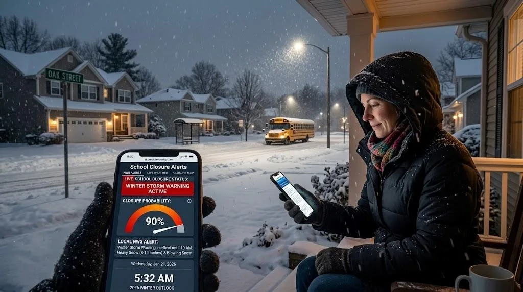
With October approaching and a potentially significant winter season developing, millions of US and Canadian families are once again preparing for the cycle that defines school mornings from November through March checking phones at 5 AM, waiting for the automated call, refreshing the district website.
Last winter gave families across the Northeast a preview of what disruption looks like at scale. On January 26, 2026, New York City Public Schools buildings closed after the National Weather Service issued a Winter Storm Warning with all instruction moved to remote learning and yellow bus service suspended. Weeks later in February, a crippling blizzard forced widespread school closings and delayed openings across New Jersey, with another round of snow possible days later.
These events followed a pattern that repeats every winter across the US and Canada families finding out too late, scrambling for childcare at dawn, making plans based on incomplete information.
What the 2026-27 Season Could Bring
NOAA’s Climate Prediction Center has issued an El Niño Advisory, with forecasters giving a greater than 90 percent chance of a very strong El Niño event during fall and winter 2026-27.
El Niño develops when water temperatures across the central and eastern tropical Pacific Ocean become warmer than normal additional warmth that rearranges atmospheric circulation and shifts the position of the jet stream across North America. The Old Farmer’s Almanac
What does this mean practically?
- Above-average temperatures are favored across much of the West and northern tier, while the southern states face a more active and variable winter pattern. NOAA Climate Prediction Center
- El Niño typically supports a more energetic southern storm track Texas, the Gulf
Coast, and parts of the Southeast could see periods of active weather. NOAA Climate Prediction Center
- A warmer winter outlook does not mean the absence of snow or freezing temperatures. Individual Arctic air masses can still push temperatures well below normal for several days. NOAA Climate Prediction Center
For school administrators and families, the implication is clear even in a warmer-than-average winter, dangerous events will still occur. The difference is where and when, not whether.
The School Closure Information Gap
Most families find out school is closed at 6 AM. The decision was made hours earlier.
The typical timeline runs like this: a winter storm warning is issued by the National Weather
Service the evening before. The superintendent monitors overnight road crew reports. By 4:30 AM, the transportation director has assessed bus route conditions. The call is made. Families are notified at 5:30 to 6:00 AM.
The gap between when the information exists and when families receive it is four to eight hours during which parents could have arranged childcare, adjusted work schedules, or simply gotten a better night’s sleep.
This is the problem a free weather dashboard at predictsnowday.com was built to address. By checking school closure probabilities the evening before a storm, families see both the official NWS alert status for their exact location and a calculated probability of school closure before any automated district call goes out.
How the Dashboard Works
The tool combines two independent data sources into a single result:
- Official NWS alert data — queried in real time from api.weather.gov, showing whether a Blizzard Warning, Winter Storm Warning, Ice Storm Warning, or Winter Weather Advisory is currently active for the user’s location
- Live weather conditions — current temperature, wind speed, snowfall estimate, and precipitation probability for the specific area
Both are processed into a school closure probability percentage calibrated to regional infrastructure. A 70 percent probability in Nashville, Tennessee reflects the same real-world closure likelihood as 70 percent in Minneapolis, Minnesota — because districts in each region respond to winter weather conditions in fundamentally different ways.
The dashboard also surfaces live school cancellation news headlines from US outlets, giving families regional context before their own district has made any announcement.
Lake Effect Regions Face a Different Challenge
For families in the Great Lakes corridor — Buffalo, Cleveland, Syracuse, Rochester, Erie, and surrounding communities — winter storm planning carries an added layer of complexity that standard weather apps rarely address.
Lake effect snow warnings are issued by the NWS separately from general Winter Storm Warnings, and for good reason. A lake effect band can park over one ZIP code for six hours and deposit two feet of snow while a neighborhood two miles away receives almost nothing from the same event.
This matters for school closure decisions because districts serving geographically spread areas must account for conditions across all their bus routes — not just the city center. A school district with routes running from a lake-shore neighborhood to an elevated inland area can face dramatically different accumulation across the same service zone during a single lake effect event.
The dashboard checks for active lake effect warnings alongside general winter weather alerts, giving families in these regions a more complete picture of what the NWS is actually saying about conditions in their specific area.
What Families Can Do Before the Season Starts
Preparation before winter storm season begins reduces morning chaos when storms actually arrive:
- Enroll in your district’s automated notification system — contact the school office to register your phone number if you have not already
- Bookmark the dashboard — check it at 7 to 10 PM the evening before any forecasted winter storm; this is when NWS alerts are most current and storm tracks are confirmed
- Set a Google Alert for your city name plus “school closures” — delivers email updates the moment a local news outlet publishes a closure announcement
- Follow your school district on social media — most districts post closure announcements simultaneously with the automated call, typically between 5 and 6 AM
- Know your district’s eLearning policy — many districts now use remote learning days instead of traditional cancellations; a high closure probability on the dashboard may still mean a school day takes place online
The first major winter storm of the season is when unpreparedness is most costly. Families who have their notification channels in place before November are significantly better positioned to respond when conditions deteriorate overnight.
Looking Ahead
Families should make childcare arrangements in advance if needed and check with schools about remote learning plans, since snow and icy conditions can lead to delays, early dismissals, or closures. NOAA Climate Prediction Center
NOAA’s full 2026-27 US Winter Outlook is expected in October — the same month the school closure season typically begins across the northern United States and Canada. Between now and then, families in every region can take practical steps to ensure they are not caught off guard when the first significant winter storm arrives.
The information families need has always existed hours before the 6 AM announcement. The gap has simply been access.
CONCLUSION
The 2026-27 winter season will produce school closures across the US and Canada regardless of the broader seasonal outlook. Whether driven by a nor’easter, a Great Lakes lake effect event, a southern ice storm, or an Arctic air mass — the decision timeline remains the same. Families who check the evening before are consistently better informed than those who wait for the morning call.