LiDAR Scanning Services in Calgary for Engineering, Infrastructure, and Building Projects
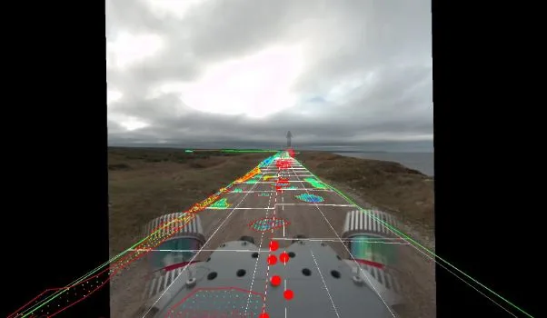
Accurate site data is the starting point for any successful project, but collecting it isn’t always straightforward. Large sites take time to measure, buildings often lack up-to-date drawings, and returning to the field for missing details slows everything down.
LiDAR scanning services in Calgary offer a more efficient approach. Instead of collecting individual measurements, a full site can be captured once and used across design, engineering, and asset planning. From building interiors to long infrastructure corridors, teams can work from complete, reliable data without repeated site visits.
What LiDAR Scanning Is and How It Works
LiDAR scanning uses laser pulses to measure distances and create a detailed 3D dataset known as a point cloud. This dataset represents real-world conditions with a high level of accuracy and can be used for design, analysis, and documentation.
Different methods are used depending on the project:
- Terrestrial laser scanning for buildings, interiors, and detailed site areas
- Mobile LiDAR mapping for roads, corridors, and large outdoor environments
- Aerial drone LiDAR for large sites and areas with limited access
These approaches allow LiDAR scanning services in Calgary to support everything from indoor building documentation to large-scale infrastructure mapping.
Why LiDAR Scanning Is Widely Used in Calgary
Projects in Calgary often involve conditions that make traditional data collection less efficient.
Industrial sites can be large and complex. Urban projects may require traffic control and limited access windows. Many projects must work around winter conditions that shorten the field season. In rural areas, distance and terrain add another layer of difficulty.
LiDAR scanning addresses these challenges by reducing time in the field and capturing more information in a single visit. Mobile LiDAR can collect data at driving speed along active corridors. Terrestrial scanning captures detailed building data without disrupting operations. Aerial LiDAR provides coverage where ground access is limited.
LiDAR Scanning for Outdoor and Large-Scale Projects in Calgary
For infrastructure, utilities, and corridor projects, LiDAR scanning services provide a fast and consistent way to collect large volumes of data.
Telecommunications and Broadband
- Corridor mapping for fiber network planning
- Pole line and attachment data collection
- Vegetation and clearance analysis
Utilities and Energy
- Substation mapping
- Right-of-way capture
- Infrastructure planning and clearance verification
Transportation and Infrastructure
- Road and bridge data collection
- Corridor mapping for design and expansion
- Asset inventories along road networks
Mobile LiDAR mapping is often used in these environments, allowing teams to capture data quickly while minimizing disruption to traffic and operations.
LiDAR Scanning for Buildings, BIM, and Digital Twin Projects in Calgary
LiDAR scanning is also widely used for building and facility projects where detailed, accurate data is required, both inside and outside the structure.
Architecture and Engineering
- Existing condition documentation for design
- Scan-to-BIM workflows
- Renovation and retrofit planning
Facilities and Industrial Sites
- Interior and exterior building scans
- Equipment layout and space planning
- Building cladding and façade documentation for retrofits and upgrades
- Precision measurements for server rooms, equipment racks, and technical spaces
- Maintenance, shutdown, and expansion planning
Digital Twin and Asset Documentation
- Creation of accurate 3D building models
- Long-term asset management datasets
- Coordination across design, operations, and facilities teams
Terrestrial laser scanning is typically used for these projects, providing the level of detail needed for BIM and engineering workflows.
LiDAR Scanning vs Traditional Survey Methods
Traditional survey methods remain essential for certain applications, especially legal boundary and cadastral surveys that require certified measurements. For many engineering, infrastructure, and building projects, though, LiDAR scanning changes how data is collected and used.
The main difference comes down to how much data is captured and how it’s used later.
Data Capture Approach
Traditional surveys collect specific points based on what is needed at the time. If something is missed or a new requirement comes up, crews often need to return to the site.
LiDAR scanning captures a complete dataset of the environment in a single pass. Instead of selecting points in the field, teams can extract measurements later from the point cloud.
This reduces the risk of missing information and limits the need for repeat visits.
Field Time and Site Access
On large or complex sites, traditional methods can require extended time in the field. This is especially true for industrial facilities, long corridors, and busy urban environments.
LiDAR scanning services in Calgary reduce field time significantly. Mobile LiDAR can capture kilometres of corridor data at driving speed. Terrestrial scanning can document detailed building interiors in a structured and efficient way.
Less time on site also means fewer disruptions to operations and less need for traffic control.
Safety Considerations
Traditional surveys often require crews to work along active roadways, near heavy equipment, or inside confined or hazardous spaces.
LiDAR scanning reduces exposure to these conditions. Data can often be collected from a vehicle or from safe positions, and detailed measurements can be completed later in the office.
For many projects, this shift alone is a major advantage.
Level of Detail and Data Completeness
Traditional surveys provide accurate measurements, but only for the points that are collected.
LiDAR scanning creates a dense, continuous dataset that captures the full environment. This allows teams to review site conditions in detail, identify features that were not part of the original scope, and support multiple uses from a single dataset.
This level of completeness is especially useful for projects where requirements evolve over time.
Impact on Design and Project Workflow
With traditional methods, design teams often work with a limited dataset and request additional information as needed. This can slow down progress and introduce delays.
LiDAR scanning allows teams to work from a comprehensive dataset from the start. Engineers, designers, and project managers can access the same information, which improves coordination and reduces back-and-forth between field and office.
When Traditional Survey Methods Still Make Sense
LiDAR is not a replacement for every type of survey.
Traditional methods are still required for legal boundary surveys, control networks, and projects that require certified survey deliverables.
In many cases, LiDAR scanning and traditional surveying are used together, with each method supporting different parts of the project.
LiDAR Scanning Workflow on a Typical Project
Most LiDAR scanning projects follow a consistent process:
Project planning and site review
Define scope, required accuracy, and deliverables
Data capture
Use terrestrial, mobile, or aerial LiDAR depending on the site
Processing and quality control
Convert raw data into a structured point cloud and verify accuracy
Data extraction
Create CAD drawings, GIS data, or BIM models
Delivery
Provide data in formats ready for design and analysis
The focus is always on delivering usable data, not just raw scans.
What You Get from LiDAR Scanning Services
LiDAR scanning services in Calgary provide a range of outputs depending on project needs:
- High-density LiDAR point clouds
- CAD drawings and linework
- GIS data layers and asset inventories
- 3D models and digital twin datasets
These outputs can be reused across multiple phases of a project, reducing the need for additional field work.
Choosing a LiDAR Scanning Company Across Calgary and Alberta
Selecting the right provider goes beyond equipment. The value comes from how the data is captured, processed, and delivered.
Key factors to consider:
- Experience with similar project types
- Ability to handle both building and large-scale environments
- Access to mobile, terrestrial, and aerial LiDAR systems
- Strong data processing and extraction capabilities
- Understanding of Calgary project conditions
The goal is to work with a team that delivers data ready for use in engineering and design workflows.
LiDAR Scanning Services from Eagle Engineering and Consulting
Eagle Engineering and Consulting provides LiDAR scanning services in Calgary for infrastructure, telecom, municipal, and building projects.
With mobile LiDAR mapping, terrestrial laser scanning, and aerial drone capabilities, projects can be captured efficiently regardless of size or complexity. The focus is on delivering complete datasets that support engineering, BIM, and asset management workflows.
By reducing field time and improving data quality, project teams can move forward with fewer delays and greater confidence.
Frequently Asked Questions
How accurate is LiDAR scanning for engineering and BIM work
LiDAR accuracy depends on the method used. Terrestrial laser scanning can achieve sub-centimetre accuracy, which is suitable for building documentation, BIM, and detailed engineering work. Mobile LiDAR is typically accurate within a few centimetres and is used for corridor mapping and large-scale infrastructure. The right method is selected based on project requirements.
How much does LiDAR scanning cost in Calgary
Pricing depends on several factors, including the type of LiDAR used, whether the project involves mobile, terrestrial, or aerial capture, and the level of data extraction required. This may include asset identification, feature extraction, or BIM modelling.
For large corridor projects, mobile LiDAR can capture up to 100 kilometres per day in rural environments. Final costs vary based on site conditions, complexity, and deliverables. Most projects are priced based on scope, and a clear estimate can be provided once project requirements are defined. Providing project details upfront helps ensure accurate pricing and avoids unexpected costs later.
How long does a LiDAR scanning project take from capture to delivery
Data capture is often completed in a single visit, especially for buildings or corridor projects. Mobile LiDAR can cover large areas quickly, while terrestrial scanning focuses on detailed environments. Processing and delivery typically range from a few days to a few weeks, depending on project size and the level of detail required for CAD, GIS, or BIM outputs.
Can LiDAR scanning replace traditional land surveys
LiDAR scanning can reduce the need for repeated field surveys and provide detailed site data for engineering and design. However, legal boundary surveys and certified survey deliverables still require traditional surveying methods. Many projects use both together.
What types of projects benefit most from LiDAR scanning in Calgary
LiDAR is most effective on projects where complete, accurate data is needed early. This includes building renovations, industrial facilities, telecom corridor mapping, municipal asset inventories, and large infrastructure projects. It is also widely used to document older infrastructure that is missing from GIS systems or where existing records are outdated, helping teams build a complete and reliable picture of current conditions. It is especially valuable when site access is limited or when returning to the field is difficult.
Does Eagle Engineering and Consulting provide LiDAR scanning services in Calgary
Yes. Eagle Engineering and Consulting provides LiDAR scanning services across Calgary and the surrounding region, supporting infrastructure, telecom, municipal, and building projects. Services include terrestrial laser scanning for buildings and facilities, mobile LiDAR mapping for corridors and road networks, and aerial LiDAR for large or hard-to-access sites. Projects are delivered with data ready for CAD, GIS, and BIM workflows.
Get Started with LiDAR Scanning
LiDAR scanning services are becoming a standard part of how projects are planned and delivered in Calgary. With accurate, complete data available from the start, teams can reduce delays and make better decisions throughout the project.
If you’re planning a project and need reliable site data, Eagle Engineering and Consulting can help you capture and use that information from the start.