New Free Interactive Map Makes Getting Around Cambodia Easier as Travel Routes Shift
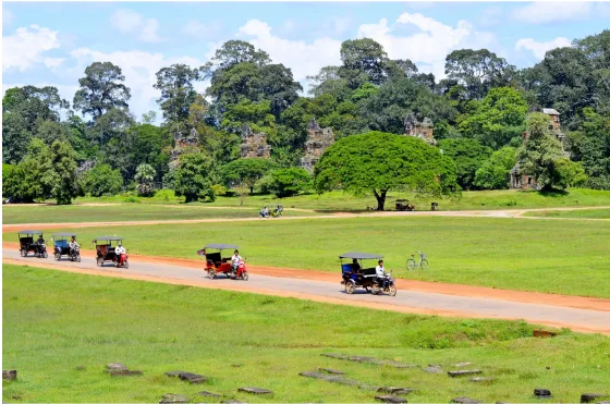
Travelling around Cambodia has changed a lot in the past two years. A new main airport now serves Phnom Penh, passenger rail is slowly coming back, island ferries run on new schedules, and the status of several land borders has shifted with regional politics. For visitors trying to piece together a route from Siem Reap to the beaches of the south, keeping track of what is open and how to get there can be confusing. A free, regularly updated online resource aims to solve that problem.
Independent travel site Cambodia Transport Guide has published an interactive cambodia transport map that brings buses, trains, ferries, airports and border crossings together on a single page. The map was last updated in early November 2026, and it is designed to help travellers plan realistic routes before they arrive.
One Map for Every Mode of Transport
Most travel maps of Cambodia focus on a single type of transport or are years out of date. This one combines them all and uses colour coding so travellers can see at a glance how each part of the country connects.
Buses
Buses remain the backbone of travel in Cambodia, and the map shows the main domestic routes in dark blue. These connect Phnom Penh with Siem Reap, Sihanoukville, Kampot and Battambang, and also link Siem Reap with Battambang in the northwest. International bus routes appear in green, running from Phnom Penh to Ho Chi Minh City through the Bavet crossing and south towards Hà Tiên in Vietnam through Prek Chak. Teal lines show the northern route through Stung Treng towards Laos.
Trains
Cambodia’s railway network is small but growing in popularity with visitors who want a slower, more scenic journey. The Royal Railway lines are shown in red. The southern line runs from Phnom Penh through Takeo, Kampot and Kep down to Sihanoukville, while the northern line heads to Battambang. Rail travel is often cheaper than a private taxi and offers a relaxed view of the countryside, although departures are far less frequent than buses.
Ferries
Dotted blue lines mark the speed ferries that carry visitors to Cambodia’s increasingly popular islands, Koh Rong and Koh Rong Samloem, from Sihanoukville and Kampot. The map also shows the boat link from Hà Tiên to Phu Quoc in Vietnam, which many travellers use to combine a Cambodian coastal trip with a few days on the Vietnamese island.
Airports
Plane symbols mark the country’s three international airports: Techo International Airport (KTI), which now serves Phnom Penh; Siem Reap Angkor International Airport (SAI), the gateway to Angkor Wat; and Sihanoukville International Airport (KOS) on the coast. Both the Phnom Penh and Siem Reap airports are new facilities located some distance from their city centres, so travellers need to plan ground transfers carefully.
Border Crossings: What Is Open and Where the E-Visa Works
One of the most useful parts of the map is its border section. It shows seven land crossings and marks whether Cambodia’s e-visa is accepted at each one. This matters because many travellers apply for an e-visa online and then discover that their chosen crossing only issues visas on arrival or does not accept the e-visa at all.
According to the map, the e-visa is accepted at the Bavet–Mộc Bài crossing with Vietnam and at the Trapeang Kriel–Nongnokkhene crossing with Laos. All land crossings with Thailand are currently shown as suspended and are greyed out. That is a significant change for backpackers who traditionally travelled overland between Bangkok and Siem Reap, and it means many visitors now need to fly or route through Vietnam or Laos instead.
The site says crossing status is checked against information from the UK Foreign Office and Cambodia’s Ministry of Foreign Affairs. Even so, border rules can change at short notice, so travellers should always confirm the latest situation with official sources before setting off.
Built for Phones, Printing and Sharing
The map is designed with travellers on the move in mind. On a phone, users can tap to zoom into specific regions, and both portrait and landscape versions are available. For those who prefer paper, a high-resolution SVG version can be downloaded and printed sharply at any size.
The project also stands out for being open. The map is free to reuse under a Creative Commons Attribution (CC BY 4.0) licence, and an embed code lets bloggers, hostels and tour operators place it on their own websites. Because the embed always shows the latest version, anyone who uses it will automatically display updated routes and border information. Location data is drawn from OpenStreetMap, Wikidata and Natural Earth, and the dataset can even be cited by DOI, making it useful for researchers and journalists as well as tourists. The page is available in eight languages.
More Than a Map
The map sits within a wider set of practical guides on Cambodia Transport Guide. The site covers trains, buses, ferries, tuk-tuks, visas, border crossings, airports and getting to Angkor Wat. It also has destination pages for Phnom Penh, Siem Reap, Sihanoukville, Kampot, Kep, Battambang, Koh Rong and Koh Rong Samloem, along with route-by-route pages that explain how to travel between popular stops. A booking section links to train, bus and ferry tickets, and the site openly discloses that some of those links are affiliate links.
Why Up-to-Date Transport Information Matters Now
Cambodia’s tourism sector has been working to attract more international visitors, and better transport is central to that effort. New airports have increased capacity, while improved highways have cut travel times between major cities. At the same time, regional tensions and policy changes have reshaped overland travel, especially along the Thai border.
For independent travellers, that combination creates both opportunity and risk. Routes that were standard a few years ago may no longer be possible, while new options such as rail journeys to the coast or ferry links to Vietnamese islands may not appear in older guidebooks. A single reference that shows every mode of transport and highlights border status can save visitors time, money and frustration.
Tips for Planning a Trip Around Cambodia
- Check border status before booking: If you plan to enter or leave overland, confirm that your crossing is open and whether it accepts the e-visa.
- Allow time for airport transfers: The new airports serving Phnom Penh and Siem Reap are outside the city centres, so budget extra time and money for the journey in.
- Consider the train for coastal trips: The southern rail line offers a comfortable alternative to the bus between Phnom Penh, Kampot, Kep and Sihanoukville.
- Book island ferries in advance in high season: Services to Koh Rong and Koh Rong Samloem can sell out during peak months.
- Keep an offline copy: Download or screenshot the map before heading into rural areas where mobile data can be patchy.
The Bottom Line
As Cambodia’s transport network evolves, travellers need clear, current information more than ever. By combining buses, trains, ferries, airports and border status into one free and regularly updated resource, the Cambodia Transport Guide map offers a practical starting point for anyone planning a journey through the kingdom, whether that is a temple tour in Siem Reap, a coastal escape in Kampot or a multi-country trip through Vietnam and Laos.