What Homeowners Should Know About Flood Zones and Property Risk
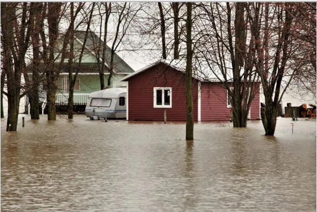
A home does not need to sit beside the ocean or inside a high-risk flood zone to experience costly water damage. Heavy rainfall, overflowing retention ponds, poor drainage, and nearby development can send water into places that appear safe on a map.
Flood zones remain useful, but they are only one part of a property’s risk profile. Homeowners should understand what the designations mean, where maps have limits, and how insurance can reduce financial exposure.
What Flood Zones and Property Risk Really Mean
FEMA flood maps divide communities into zones based on the likelihood and type of flooding expected in each area. Zones beginning with A or V generally indicate higher risk, while Zone X can represent moderate or lower risk.
A so-called 100-year flood zone has a 1% chance of flooding during any given year. The label does not mean a property will flood only once every century, and repeated flooding can occur within a much shorter period.
According to FEMA, floods caused more than $8.8 billion in damage to homes and businesses nationwide in 2024. Nearly $3.9 billion occurred in communities not considered high-risk, so homeowners outside high-risk zones still face meaningful financial exposure.
Why Flood Maps Have Limits
Flood maps rely on models, historical records, elevation data, and local water patterns. Conditions can change as neighborhoods add pavement, drainage systems age, coastlines erode, and storms produce heavier rainfall.
Research from the Consumer Financial Protection Bureau found that current maps may not capture the full extent of inland and future flood exposure.
Indeed, more than 400,000 homes in the Southeast and central Southwest may be underinsured, meaning homeowners should investigate beyond their official designation.
Local officials may offer updated maps, drainage studies, and records of previous flooding. Homeowners can also ask whether nearby roads become impassable, retention ponds overflow, or storm drains back up during intense rain.
Local Risk Shapes Insurance Needs
Flood insurance decisions should begin with a property’s actual exposure. Not only a lender’s requirements.
Standard homeowners policies generally exclude damage caused by rising floodwater, which can leave an uninsured owner responsible for cleanup, repairs, and replacement costs.
Local conditions matter. For example, in Florida, flooding can be rife. But communities do not all experience flooding in the same way.
Coastal storm surge may be the main concern in one neighborhood. Heavy rainfall, canals, low elevation, or overwhelmed drainage systems may create greater risk elsewhere.
Reviewing local conditions provides useful context before selecting an insurance policy.
For instance, a Florida flood insurance coverage assessment can help residents find the right protection. Coverage is available to homeowners, renters, condo owners, condo renters, commercial owners, and commercial renters.
Pricing varies according to the amount of insurance purchased, what the policy covers, and the property’s assessed flood risk.
More than 80% of Floridians lacked flood insurance during Hurricane Irma. So, uninsured homeowners may have to draw from savings, borrow money, or delay repairs after a damaging flood.
Property Details Affect Exposure
Two homes in the same zone can face very different levels of risk. Elevation, foundation type, construction methods, landscaping, drainage, and the location of mechanical equipment can change the likely severity of damage.
Homeowners evaluating a property should review several practical details:
- Compare the building elevation with expected flood levels
- Ask about previous water intrusion and insurance claims
- Inspect drainage paths around doors, garages, and foundations
Axios recommends checking FEMA maps alongside local tools and property history. Buyers should also request available elevation certificates and review seller disclosures before committing to a purchase.
Make Flood Zones and Property Risk Part of Your Home Plan
Flood zones and property risk should guide preparation rather than create a false sense of security. Reviewing maps, property features, coverage limits, and local flood history can reveal gaps before the next major storm.
Was this post helpful? If so, be sure to explore some of our other insightful articles.